
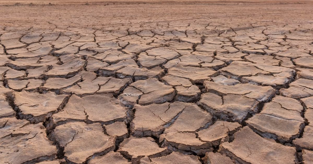
More than half of Tennessee is now experiencing drought conditions, according to experts at ETSU’s Tennessee Climate Office, with additional degradation likely in the coming weeks.
Dry conditions are tightening their grip on Tennessee, with more than half the state experiencing some degree of drought.
“We’re seeing conditions worsen quickly across all three major regions of the state,” said Dr. Andrew Joyner, Tennessee’s state climatologist and an associate professor in ETSU’s Department of Geosciences. “Most areas received less than a quarter-inch of rain during the last monitoring period, and streamflow is below average in many places, with some streams running much below normal.”
How bad is the drought in Tennessee?
The numbers tell the story.
Moderate drought covers just over half of Tennessee, a jump of more than 41 percentage points in just one week.
Large portions of Northeast Tennessee have also shifted into moderate drought, while areas along the Kentucky and Virginia borders are trending drier. Severe drought has struck southeast Tennessee, particularly in counties near Chattanooga.
Those terms are more than descriptors. The U.S. Drought Monitor uses a five-level scale to track drought nationwide, ranging from D0 (abnormally dry) to D4 (exceptional drought). Moderate drought (D1) marks the first official drought category, while severe drought (D2), the second of four drought levels, signals mounting impacts to agriculture, water supplies and streamflow.
Officials at East Tennessee State University’s Climate Office help supply the data that determines where those lines are drawn. That information can ultimately affect when farmers and communities qualify for emergency assistance.
The short-term forecast may offer some relief. Johnson City, for instance, is likely to see rain this weekend. But there’s little chance of precipitation again until Saturday, Jan. 17.
The longer-term forecast for late January looks a bit more promising, with above average precipitation expected for the northern half of Tennessee.
Drought impacts this time of year are typically minimal. Underground water recharge and wildfires are the biggest concerns, though current dry conditions are not yet leading to these impacts. Nearby Western North Carolina, however, is forecast to have significant wildland fire potential for the remainder of the winter.

Why ETSU’s Climate Office matters
Housed at ETSU, the Tennessee Climate Office plays a central role in drought monitoring and weather research, reinforcing the university’s role as the flagship institution of Appalachia.
Joyner, Assistant State Climatologist Wil Tollefson and Chief Drought Officer Elijah Worley contribute critical data to the U.S. Drought Monitor. It’s the national system used by federal agencies to determine drought declarations and eligibility for assistance programs.
The office is also one of only nine sites nationwide selected for a pilot program aimed at helping communities better understand and apply climate data as they prepare for extreme weather.
As drought conditions extend into the new year, the Climate Office will continue tracking precipitation, streamflow and agricultural impacts across Tennessee.
Joyner encourages residents to report local drought conditions through the National Drought Mitigation Center.
.jpg)
.jpg)
.jpg)